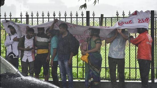
Thunderstorm brings heavy rainfall to city after two weeks
Another spell of heavy rain is expected in the city after September 7, when a fresh low-pressure area is expected to form off the coast of Odisha, and then travel westward
Mumbai: A thunderstorm that began late on Saturday night and continued into the early hours of Sunday brought heavy rain to the city after a two-week-long spell of hot, muggy weather. The city had last seen a prolonged bout of heavy rain on August 16.

Saturday night’s showers were extremely scattered, with wide variability between the city and suburbs. While the India Meteorological Department’s (IMD) weather station in Santacruz recorded 94mm of rain in the 24 hours ending 8:30am, the IMD station in Colaba recorded just 8.3mm of rain in the same period.
“This was not a typical monsoon shower. It was a thunderstorm, which is very localised. The increasing heat in Mumbai over the last few days, along with high levels of humidity created the perfect condition for convective activity, leading to Saturday night’s rain. It was not because of typical monsoon factors, such as strong westerly winds or a low-pressure area in the Bay of Bengal. However, westerly winds have resumed since Sunday afternoon and some light to moderate isolated showers are likely in Mumbai over the next two days,” said a senior meteorologist with the IMD’s regional forecasting centre in Mumbai.
Another spell of heavy rain is expected in the city after September 7, when a fresh low-pressure area is expected to form off the coast of Odisha, and then travel westward. An east-west wind shear zone around the southern tip of India, near Kerala, is expected to move upwards in the coming days after the LPA forms around September 7. This will result in stronger westerly winds which, under the influence of the LPA, will pull moisture over the Konkan coast.
An intensification of rainfall activity may also happen toward the end of the month, as Super Typhoon Hinnamnor moves further eastwards and weakens. Disrupted monsoon flows over the South China Sea may re-converge. As pulses from these systems move toward the Bay of Bengal, the area could once again start actively hosting back to back low-pressure systems, which could bring a final, prolonged spell of wetness to Mumbai and surrounding areas before the monsoon season closes out.
As of 8:30am on Sunday, Mumbai has received 2193.3, which is 160.5mm more than normal up to the date. Though a yellow alert was sounded by IMD for the city on Sunday, with chances of more thunderstorm activity and high wind speeds, Mumbai has been placed under a green category weather alert till September 8, indicating only light, isolated showers.


