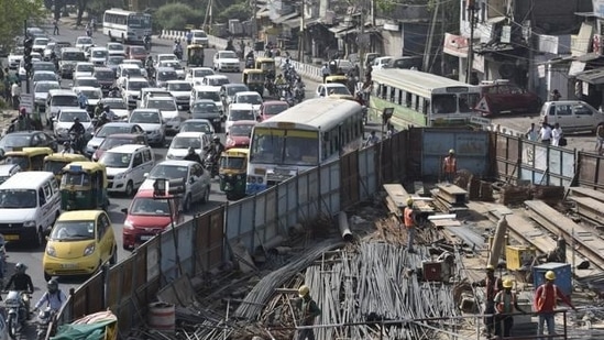
Delhi not adequately accessible for its residents, finds study
Delhi gasps from the compounding problem of unplanned colonies, lack of adequate streets, lacking last-mile connectivity and non-motorised transport facilities.
Delhi has ignored the needs of low-income settlements by providing access to adequate public transport and sufficient street space, thereby distancing them from centres of economic opportunity and state-of-the-art services that the national capital offers to planned and richer neighbourhoods, a recent study conducted by policy think-tank Centre for Science and Environment (CSE) found.

The study also sheds light on the elephant in the room: Less-then-ideal last-mile connectivity and haphazard urban designs distance cities from sustainable mobility solutions that emerge from the travel patterns of the poor.
The report, How accessible are low-income settlements: The case of Delhi, released on Tuesday showed that unplanned, low-income areas in the national capital region have very limited access to affordable and efficient public transport services while the planned and swankier areas are comparatively better connected, but are still not up to the mark.
"If all settlements of Delhi — planned and unplanned — are not equally well connected with public transport services and are not made accessible, the capital will fail to implement fully its sustainable, low-emission forms of travel such as walking, cycling or public transport," the report highlighted.
As per the estimates of the draft Delhi Master Plan 2041 (MPD 2041), the city’s population is expected to touch 27-to-30 million by 2041, and 50% of this increase would happen on account of migration. By then, Delhi would generate 46.2 million motorised trips every day.
“If such a massive load of daily motorised travel trips are not shifted to public transport to achieve the MPD 2041 target of a modal split of 80:20 in favour of public and shared transport, Delhi will remain locked in pollution and carbon trap,” says CSE executive director Anumita Roychowdhury.
The CSE conducted a ground-level assessment of infrastructure for accessibility in 16 settlements in the southern part of Delhi and took into account neighbourhoods of varying economic status, with a special focus on the vulnerable urban poor.
The diverse settlements included unauthorised colonies that have been subsequently regularised such as Tughlakabad Extension, Tigri Extension, Govindpuri, Kalkaji, Khanpur, Pooth Kalan and Khirki Extension; resettlement colonies like Garhi and Zamrudpur in East of Kailash; and slum clusters like Jawaharlal Nehru Camp in Kalkaji. There are also villages that have become part of the urban system like Shahpur Jat and Tughlakabad village.
On the other hand, the study also focussed on planned settlements and neighbourhoods of higher-income groups, including East of Kailash, Kailash Colony, Greater Kailash and Chittaranjan Park.
"While it is challenging to quantify the differences in absolute terms, indicators have been derived from national policies, guidelines, service-level benchmarks, the Ease of Living Index of the Union ministry of housing and urban affairs, and a few global indexes related to liveability and accessibility – the aim was to broadly assess the qualitative differences between settlements, the CSE said, adding, "This is a rapid diagnostic study of equity of access, ease and affordability of movement and what determines access in different settlements."
The study found that the planned settlements and higher-income neighbourhoods perform better on most criteria compared to unplanned settlements inhabited by the people from the economically weaker section of the society. However, even planned colonies were found to be falling short of the benchmark for accessibility as provided in guidelines and standards and are deficient in public transport-oriented design.
Experts warned that the trend is an indication of over-dependence on personal vehicles in these neighbourhoods.
“These indicators bring out the relative differences in local conditions related to transport, mobility patterns and connectivity, the status of infrastructure and services, accessibility, and the increase in interchanges due to poor connectivity that has a bearing on journey costs,” says Anannya Das, deputy programme manager with the sustainable mobility programme at CSE.
Unplanned colonies, on the other hand, are hugely burdened with legacy problems as they have grown incrementally and without any planning support. They are already very densely built with hugely constrained infrastructure. There is barely any space left to manoeuvre as all vacant and open spaces have ceased to exist.
The study found out that the planned areas have, on average, 1.6 times more road space and 1.4 times more open qualitative spaces than the unplanned parts of the city mostly inhabited by people from the economically-weaker section of the society.
It further pointed out that planned settlements are about 1.3 times better connected than low-income unplanned settlements. Within the low-income settlements, planned low-income settlements have relatively better chances of being located strategically in relation to a major economic hub and important locations within a city.
"In unplanned low-income settlements, inter-modal transfer requirement increases the waiting time for a mode by 1.1–1.6 times. Most importantly, this increases the cost of the journey. In fact, the monthly cost of transport increases by 1.5–3.5 times," the CSE finding read.
Meanwhile, Roychodhury said the need of the hour was an immediate improvement in neighbourhood-scale accessibility to bus and metro services and minimisation of interchanges.
"The expectation of MPD 2041 that 50% of Delhi’s population will be within the influence zone of mass transit by 2041 and mixed-use development will encourage a shift towards public transport, can be fulfilled only if neighbourhood-level design and infrastructure improvements for safe and efficient access,” she added.
Get Current Updates on India News, Lok Sabha Election 2024 live, Elections 2024, Election 2024 Date along with Latest News and Top Headlines from India and around the world.


